Prints & Artwork / Maps & Views.jpeg) AMERICA - Panorama of Philadelphia - Province Pennsylvania - 1761 The East Prospect of the City of Philadelphia in the Province of Pennsylvania. From the London Magazine or Gentleman's Monthly Intelligencer for October 1761.... [More] £1250.00 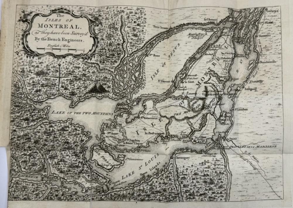 CANADA - Map of The Isle of Montreal - 1761 The Isles of Montreal as they have been Survey'd By the French Engineers. from the London Magazine or Gentleman's Monthly Intelligencer for March 1761.... [More] £300.00 .jpeg) AMERICA / BENNING, R - Plan of New Orleans the Capital of Louisiana - 1761 Plan of New Orleans the Capital of Louisiana by Robert Benning from the London Magazine or Gentleman's Monthly Intelligencer for April 1761.... [More] £375.00 .jpeg) AMERICA ( Eng ) Kitchin, Thomas - A New Map of Virginia - 1761 A New Map of Virginia from the best Authorities By T. Kitchin Geogr. From the London Magazine or Gentleman's Monthly Intelligencer for November 1761.... [More] £350.00 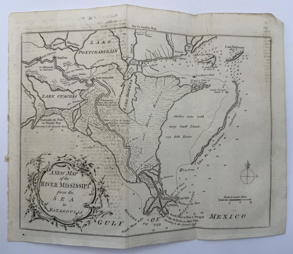 AMERICA - ( Eng) KITCHIN, T, - A New Map of the River Mississippi - 1761 A New Map of the River Mississippi from the Sea to Bayagoulas by engrave Thomas Kitchin sr, from the London Magazine or Gentleman's Monthly Intelligencer for March 1761.... [More] £350.00 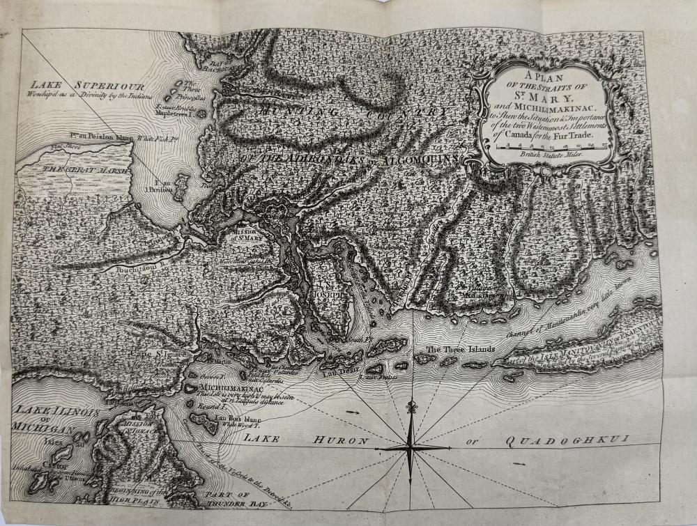 CANADA - A Plan of the Straits of St. Mary - 1761 A Plan of the Straits of St. Mary, and Michilimakinac, to Shew the Situation & Importance of the two Westernmost Settlements of Canada for the Fur Trade. From: The London Magazine or Gentlemans Monthly Intelligencer for February 1761.... [More] £325.00 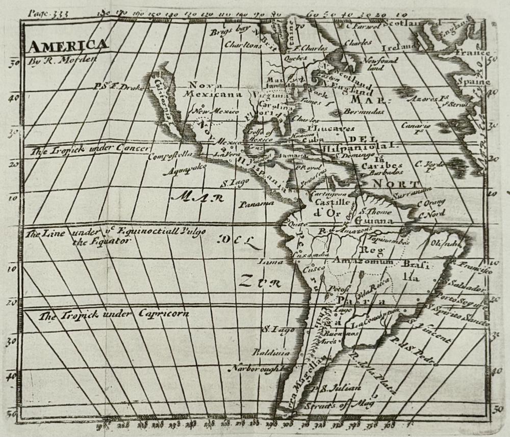 AMERICA, MORDEN, Robert - A Miniature Map of America - Circa 1711 A Miniature New Map of America by Robert Morden, circa 1711.... [More] £185.00 .jpeg) BADESLADE, T & TOMS, W. H - Chorographia Britanniae - Hand Colour Copy - c1742 Chorographia Britanniae. Or A Set of Maps of all the Counties in England and Wales: to which are prefix'd the following general Maps. I....Chart of the Sea Coast...2.. by Thomas Badeslade and William Henry Toms.... [More] £945.00 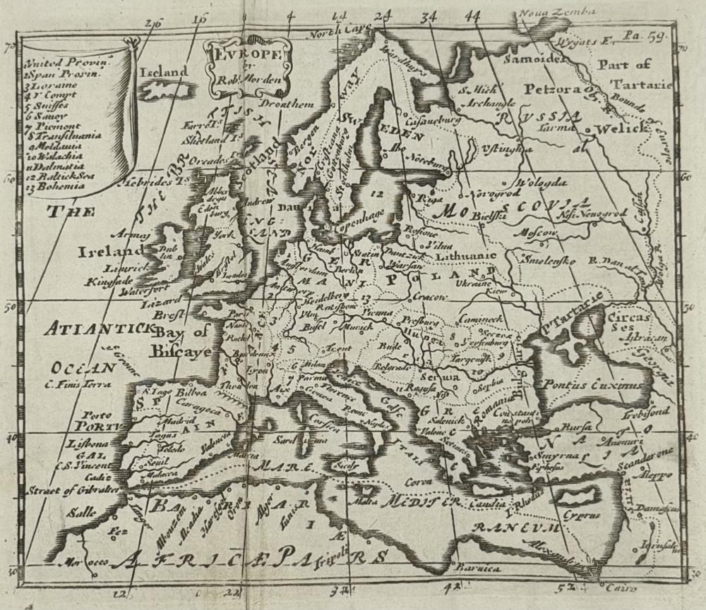 EUROPE / MORDEN, Robert - A Miniature Map of Europe - Circa 1711 A Miniature New Map of Europe by Robert Morden, Circa 1711.... [More] £100.00 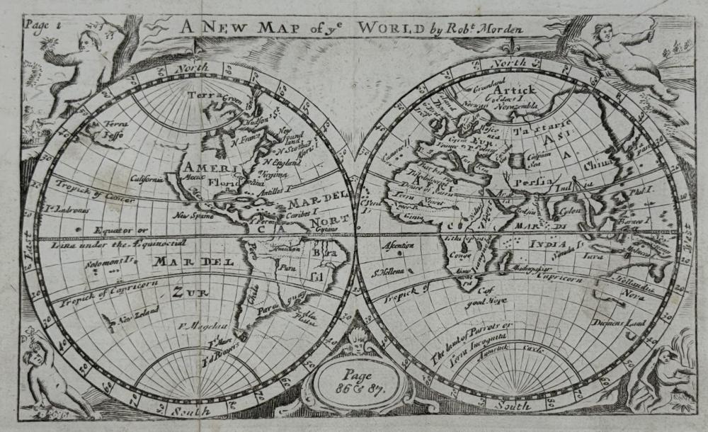 WORLD / MORDEN, Robert - A Miniature New Map of the World - Circa 1711 A Miniature New Map of the World by Robert Morden, Circa 1711.... [More] £250.00 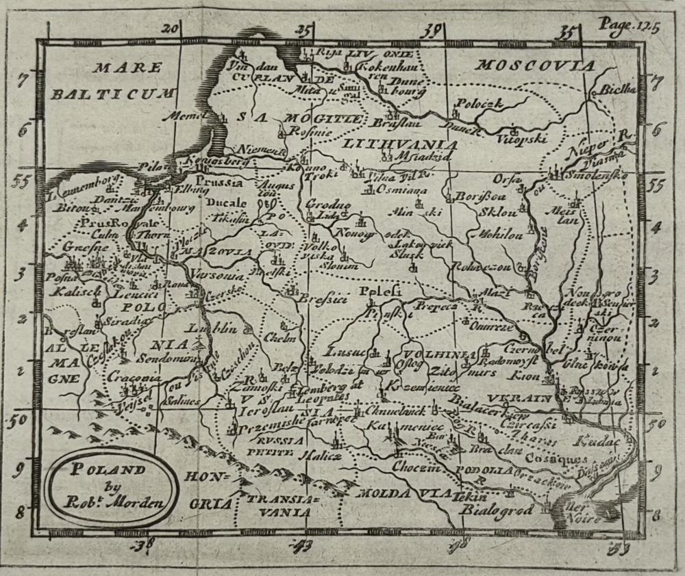 POLAND / MORDEN, Robert - A Miniature Map - Circa 1711 A Miniature Map of Poland by Robert Morden, Circa 1711... [More] £95.00 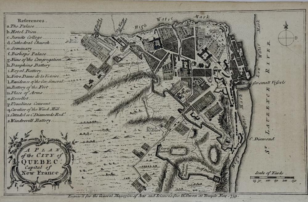 CANADA / QUEBEC - A Plan of the City of Quebec - 1759 A Plan of the City of Quebec, Capital of New France. Engraved for the General Magazine of Arts and Sciences for W Owen at Temple Bar [London] 1759. ... [More] £250.00 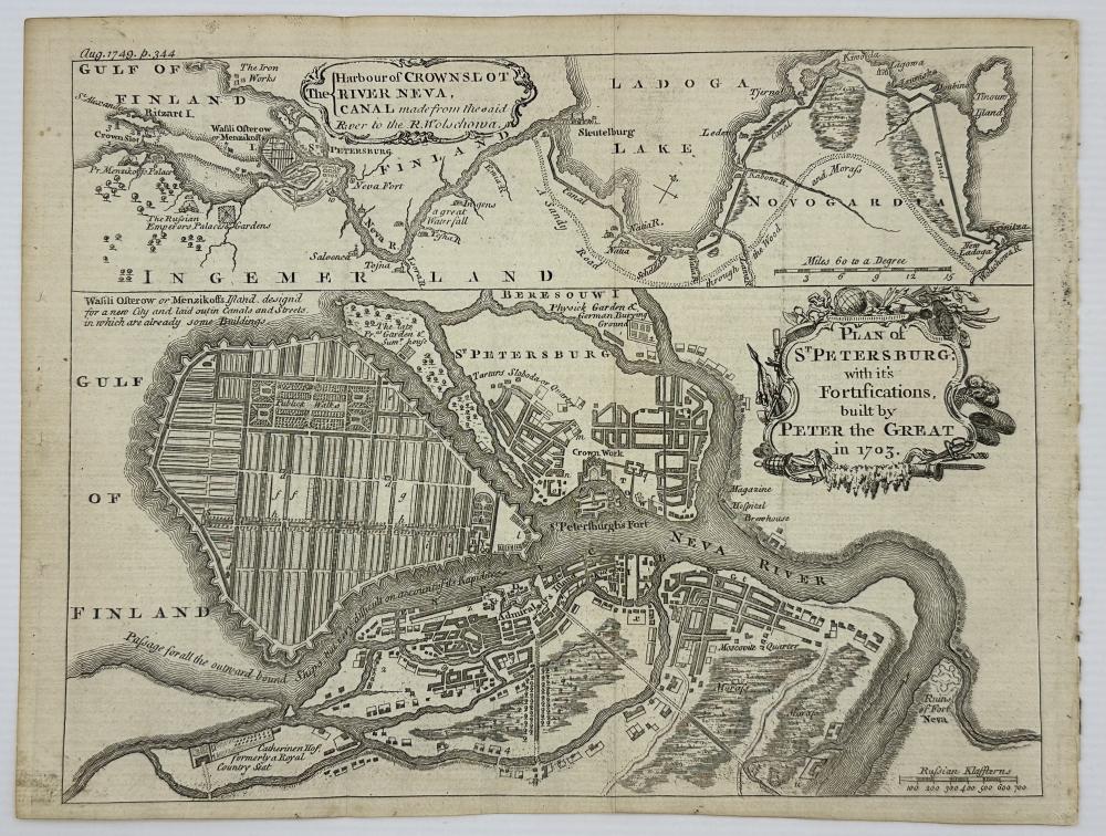 ST PETERSBURG & RIVER NEVA - Russia - Plan and Map - ( London Magazine ) 1749 Plan of St Petersburg; with it's Fortifications, Built by Peter the Great in 1703 [on sheet with] The Harbour of Crownslot River Neva, Canal Made from the Said River to the R. Wolschowa.... [More] £185.00 .jpeg) 1749 SOUTH AMERICA - Copper Engraved Map by Thomas Jeffreys South America Drawn from the best Maps by T Jeffrey's Geographer to his Royal Highness the Prince of Wales... [More] £75.00 .jpeg) Map of CAMBRIDGE 1607 by William Kip Cambridge Comitatus Quem Olim Iceni Infederun. Engraved map with old colouring.... [More] £150.00 For more items visit our AbeBooks store here. |